Section 15 Return
Five Ashes to Mayfield
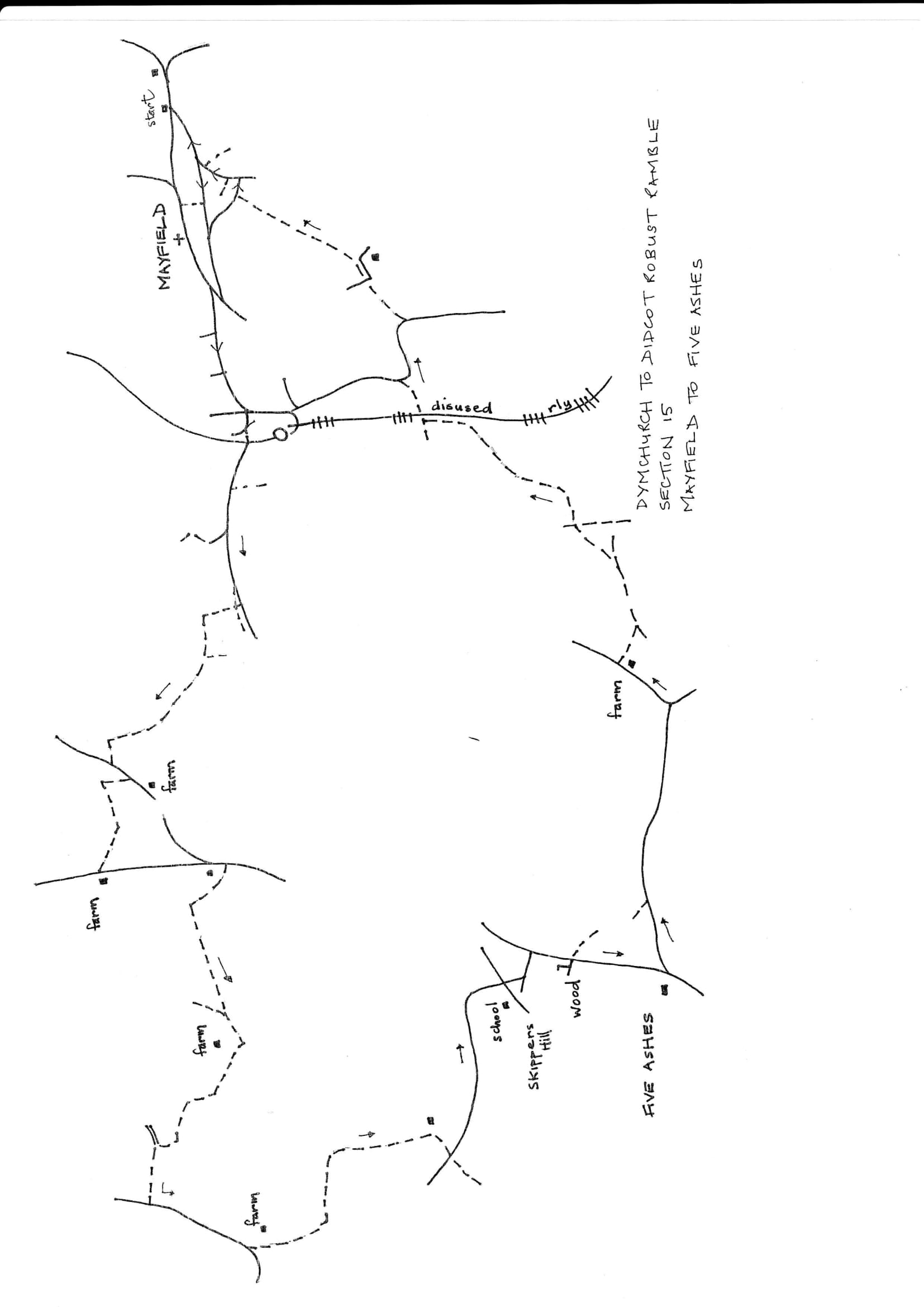
Walk Details
| Map | OS Explorer 135 Ashdown Forest |
|---|---|
| Distance | 3 miles/ 2 hours |
| Start | The Five Ashes Inn, some on street parking. |
| Comment | A short walk with some hilly stretches. A short link on a busy road without a pavement on the outskirts of Mayfield; care and a hi-viz vest desirable (light and easy to carry for all road walking). An alternative route back through the village centre is provided. |
Walk Instructions
With the Five Ashes Inn behind, cross the main road and go up Leeds Lane opposite for nearly a mile. At a Y-fork turn left up Mere’s Lane. Pass the buildings of Mere’s Farm on the right and a bungalow then turn right off the road over a stile by a wooden fieldgate.
Go away from the road through a second gate on a concrete track towards distant trees. On reaching them go through a metal fieldgate and on for ¼ mile. Where the track goes through a metal fieldgate and begins to bear right downhill, go left over a stile and up the field by the hedge on the right. At the top corner by a wood, turn right into the next field and walk down still with a hedge on the right.
At the bottom cross a footbridge into a wood and keep on upto the top. Cross a stile into a field and follow the hedge on the right to the top. Here go through a metal fieldgate and keep on up a horse paddock towards a cement stable block. Cross a stile and footbridge just in front of the stable and walk up the side to a T-junction. Turn left on a farm track and walk up for some distance passing more stables on the left. At the very top go through a wooden fieldgate to a T-junction. Turn right over an old railway bridge and follow the roadway around and up to a junction with a main road.
(the route now involves some unpleasant roadwalking to the next footpath; to avoid this turn left up to a junction then right to follow the road back into Mayfield, pass the shops then straight on down to the Carpenter’s Arms)
Turn right along and down this busy road for ¼ mile. Stay in single file facing the traffic and step off road when vehicles approach. If available wear a hi-viz waistcoat.
At the bottom of the hill, where the wood on the left ends, cross left over the road to find a footpath hidden in bushes. Follow it up along the edge of the wood to emerge into a field and continue up with a fence on the right. Go through another belt of trees and continue along with fence still on the right to reach a brick hut.
Drop down a bank on the right and go forward over a drive and up into a field beyond. Keep on in the same direction with Mayfield up ahead. At the end of the field cross a stile into a wood. Drop steeply down to a footbridge then steeply straight up the other side to a stile into a field with a church up ahead. Go up by fence on right to a stile into next field.
Go up to a further stile and cross to continue uphill. The path becomes enclosed between gardens and houses then emerges onto a road. Turn right and continue along to a junction. Bear left on the road going steeply uphill. At the next junction bear right and continue on to finally emerge at a main road opposite the former Carpenter’s Arms and the start of the section. The Rose & Crown is just down on the right.