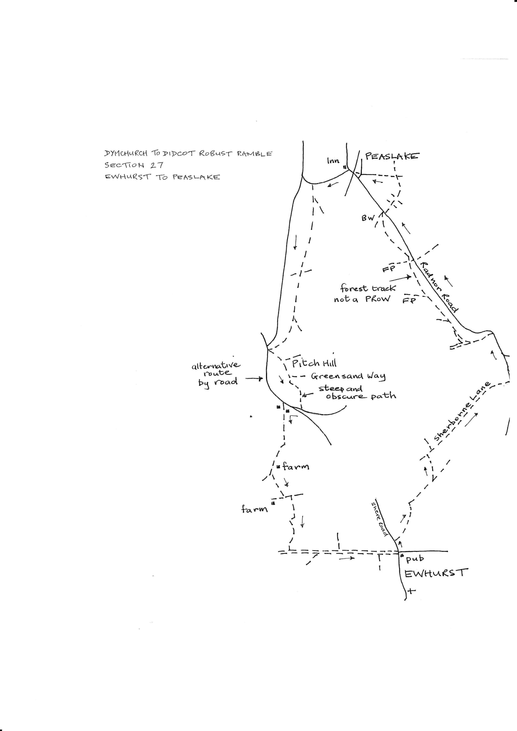
Section 27 Out
Ewhurst to Peaslake
Walk Details
| Map | OS Explorer 145 Guildford & Farnham/ 146 Dorking & Reigate |
|---|---|
| Distance/time | 4.5 miles/3 hours |
| Start | The Bull's Head at the north end of Ewhurst village |
| Comment | This is a most attractive walk in the Surrey Hills area of outstanding beauty. Most of the paths are easy to follow and there are moments of extensive views. There are several stiles and some very steep climbs so more than the usual time should be allowed for. In wet weather many of the tracks will be extremely muddy. There is a section of walk off Pitch Hill which is very steep and dangerous and should not be attempted by young children or anyone with restricted mobility. Walking poles are recommended. An alternative by road is suggested. |
Walk Instructions
With the Bull’s Head behind, face the crossroads with its mini-roundabout. Cross to the Shere Road going right uphill. In 50 metres turn right on an enclosed path between fences and hedges. Keep on through a wood. At the end of the trees cross a stile and go down the top edge of a field. Cross a footbridge and stile into the next field and keep on to a stile into a wood. Walk up the wood for some way.
Where the path narrows and drops more steeply downhill, turn left over a stile in to a field. On the OS map the path down the field goes fairly close to the hedge on the right. At the moment it is marked out going straight down the field from the stile to another stile in the bottom hedge.
On reaching this bottom stile cross onto a tarmac drive and turn right for a short way. At a gateway, turn off left onto and enclosed path up to a corner. Ignore the stile on the left. Instead turn right to go along between a fence and a hedge.
At the end, cross a footbridge and wooden gate onto a broad grassy way. Go straight ahead, ignoring a footpath off on the right. Soon enter woods and begin a long climb. Much of this section is very wet as a stream actually runs down the path. Finally cross the brow of the hill and go forward to skirt a house on your left and reach a gravel drive. Turn right on this to pass outbuildings and go up to a white fieldgate leading to a road.
Turn left up the road for ¾ mile. Pass a side road on your right. After a good distance pass a gravel parking bay and a bridleway on your right, then a house behind a hedge on your left. Immediately past the house turn left past a large log into a footpath going downhill past a seat (and views). Continue down to soon meet a sandy bridleway. Turn right on this gradually uphill through trees. At two Y-forks bear left; ignore all side and cross paths and keep following the main track as it continues to climb. Near the top of the slope pass a footpath going left down into rhododendron bushes at a waymark post.
Keep on uphill through pine trees. Eventually meet a wide forest track. Turn left on this and follow it ignoring all side and cross tracks. Eventually reach a meeting of tracks by a road on your right. Turn right to cross the road and continue on a bridleway into woods.
Ignore two cross tracks and go on, soon following a fence on your left. Eventually reach a crossing of paths by a hedge. Turn left here into an enclosed path between fences. Emerge onto a gravel drive and go on down to meet a road.
Cross the road and go on down a steep path to emerge into the centre of Peaslake Village. Bear right to the Hurtwood Inn and the end of the section.