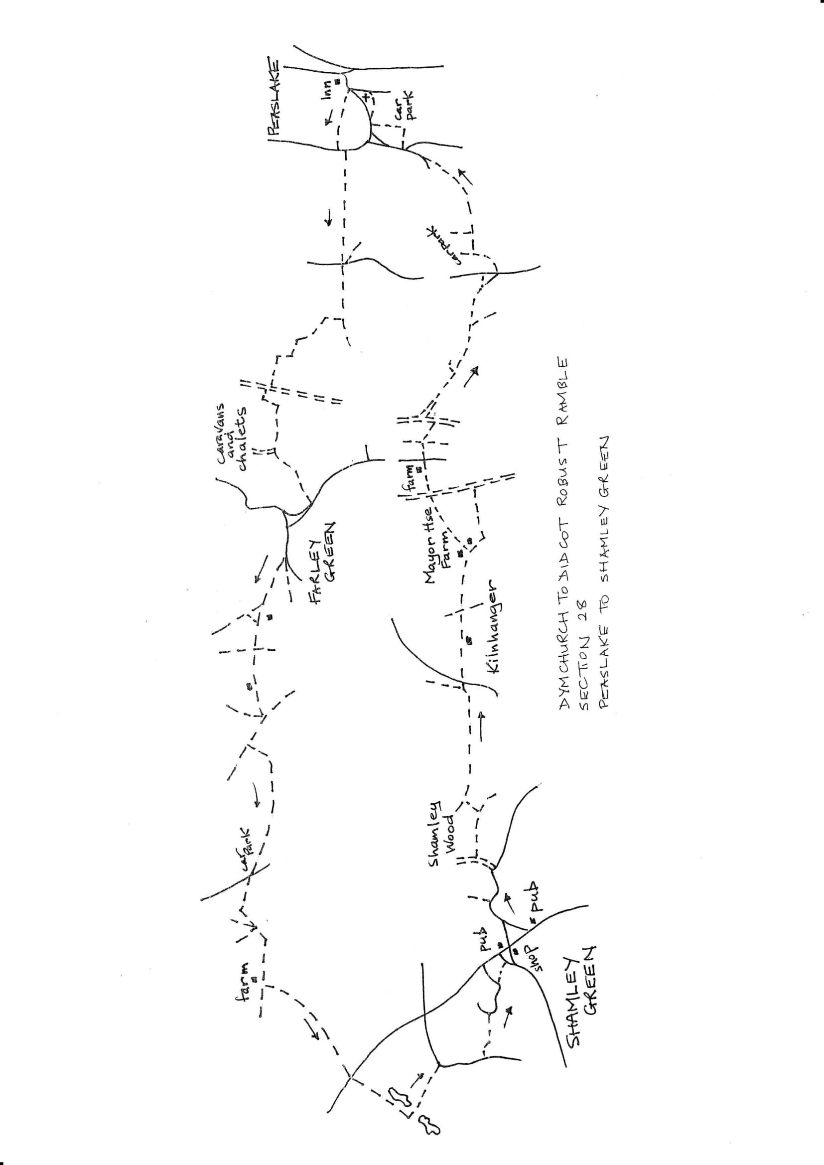
Section 28 Return
Shamley Green to Peaslake
Walk Details
| Map | OS Explorer 145 Guildford & Farnham |
|---|---|
| Distance/time | 4 ½ miles/ 3 hours |
| Start | The Red Lion pub in Shamley Green |
| Comment | Not a long walk, but quite rugged going and some off-road vehicle damage. Some good views. |
Walk Instructions
With the Red Lion on your left walk up the main road then soon left on a side road along a section of green. At the end join another road and keep on walking away from the village. Keep on as the road curves around. Ignore the first footpath off left by Sandhurst Hill. On a sharp right bend turn left up a concrete drive to Shamley Wood.
Walk up the drive to an ornamental gateway. Here turn right over a stile and continue uphill on an enclosed path between fences. Near the top turn right still following the fence on your right, to a stile into a wood (there are fine views here). Walk up the wood and on at the far side to a T-junction with a bridleway. Turn left uphill.
At the top reach a junction of tracks. Pass a field entrance on your right, then turn right on a sandy bridleway between fences. At the end of the track reach a metal fieldgate on your right. Turn right here by the gate to reach a road. Cross straight over to go up the drive to Kilnhanger. Keep on this main drive for ½ mile ignoring turnings off including a cross path where power lines pass overhead. Keep on uphill to Mayor House Farm (a footpath goes off left here but it is not signed or obvious). Keep on the main drive past the farm, over the hill then down to a junction with a sunken byway at the bottom.
Turn left on this for ¼ mile (used by off road vehicles and probably very muddy in winter which is why turning off on the footpath would have been better). Eventually reach a footpath crossing the byway on steep steps (this is the one from Mayor Farm). Turn right on this, up the bank, to a stile.
Enter a field and cross straight over, parallel to the hedge over on your right, to a stile. Enter an enclosed path and follow this past Shophouse Farm to a road. Turn left a few paces then right, off the road, over a stile into an enclosed path heading towards a wood.
At the far side cross a stile and drop down to a sunken track. Cross this and go on up the bank into a garden area. Keep on in the same direction to drop steeply down to a footbridge. Soon meet a bridleway. Turn left on this. In a few paces meet a gravel track by a hedge. Bear left on this down to a junction of tracks by a power line pole. Turn right here on a bridleway track going uphill between hedges.
Keep on the main track ignoring a cross path. Go steeply uphill then down. Ignore a path off left and continue on the bridleway. At a Y-fork, bear left and go on uphill to emerge onto a road. Turn right along it to soon reach a T-junction. Cross to continue up the bridleway drive ahead, ignoring steps on your left.
Follow the main track, passing a garden fence on your left. Where this swings down to a car park and entrance to a scout camp, go straight ahead into a wood. Keep forward for ½ mile ignoring side paths. At the end meet an asphalt drive. Turn right on this to soon reach a road.
Turn left a few paces along the road looking for a path off right down through woods. Go down this to a car park area. Turn left along the valley bottom to a road. Turn right on the road a short way. By a 30 mph sign bear right off the road onto a narrow footpath up the bank on the right to continue parallel to the road down on your left.
At the end, bear steeply right, upto an asphalt path. Turn left on this to pass Peaslake Church on your left and drop down to a road in the village centre. The Hurtwood Inn and Hotel and start of the section is just over on the right.