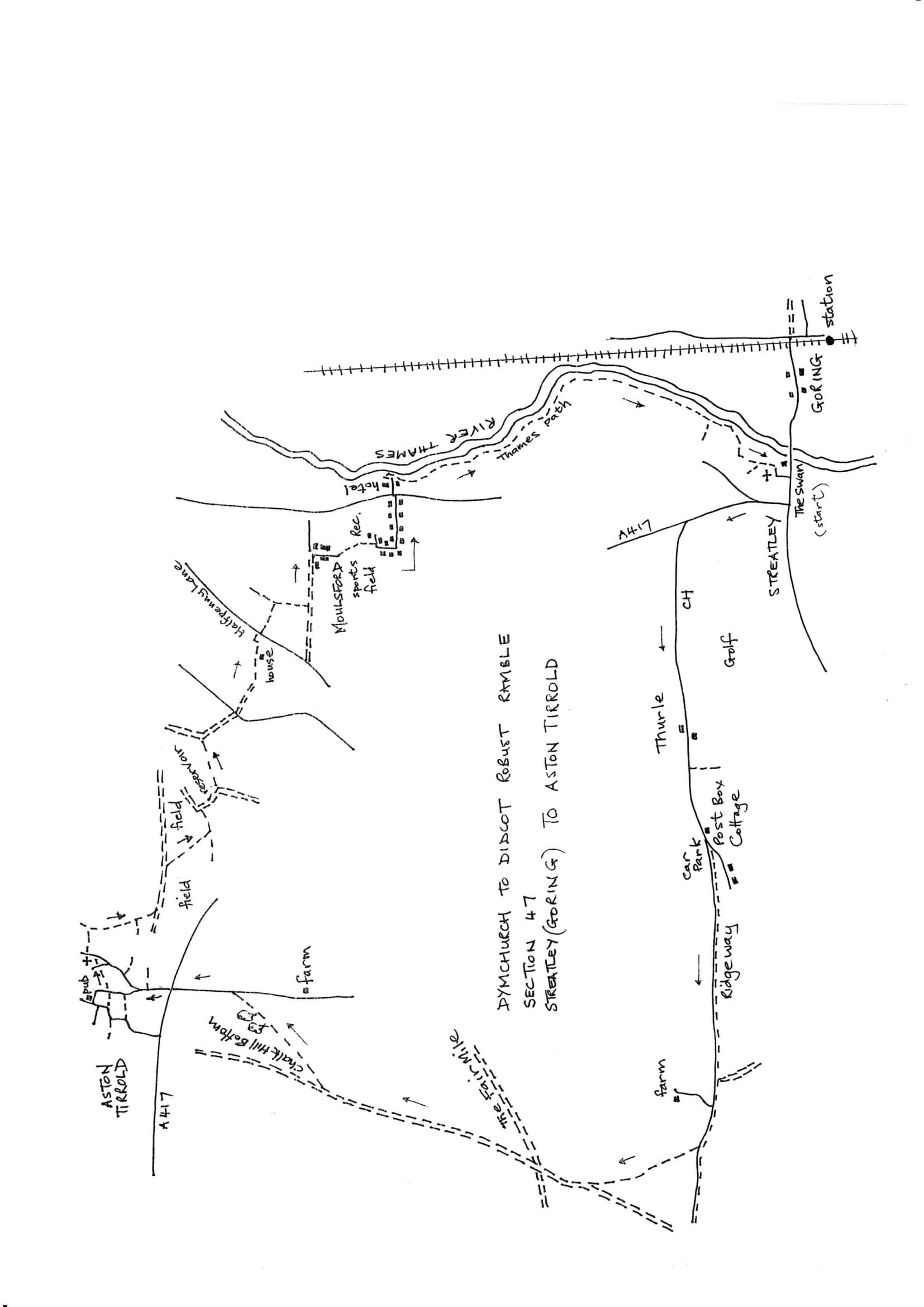
Section 47 Out
Streatley (Goring) to Aston Tirrold
Walk Details
| Map | OS Explorer 170 Abingdon & Wantage |
|---|---|
| Distance/Time | 8 miles/3.5 hours |
| Start | Cross the bridge from Goring Station to reach The Swan Inn, by the River Thames in Streatley. Ask about parking in the pub or try by the church of St. Mary just off the high Street a bit further up on the right. |
| Comment | This is a difficult area for walking as the River Thames, the Goring Gap and extensive downland restrict the number of paths. This section has to use a long section of the Ridgeway and a further long byway section plus some linking roads. These tracks are hard on the feet and can be tedious but it's possible to make steady progress and the views are good. The Chequers at Aston Tirrold is not open every day and not Sunday evening so check beforehand. This is a very hilly section. |
Walk Instructions
With The Swan Inn behind face the main road. The bridge to Goring is on your left. Turn right up the road through the village passing some excellent houses from the 16th to the 19th. Century. At the top reach a crossroads by The Bull inn.
Here turn right along the road. At a Y-fork bear left on the A417; you are now on the Ridgeway Path. In ¼ mile turn left onto Rectory Road which leads to a golf club. Keep on this roadway for 1 ½ miles passing the golf club.
The road ends at a red post box. Bear left to continue on the Ridgeway, now a stony farm track. There is a car park here.
Continue uphill for 1 ½ miles, ignoring all side tracks. Finally gain the highest part of the trail surrounded by fields. Where the Ridgeway swings left go straight on through a wide gap into a field corner (there is a waymark post here). Go straight on with a hedge on your right.
Continue on this splendid grassy path with panoramic views all round. At the far end turn right onto Byway.
After some way reach an open area with deep 4 x4 ruts, and a junction with a track called the Fairmile. Do not turn onto Fairmile but follow the ruts across, past a metal fieldgate, and on downhill.
After a mile, on a long downhill stretch, look for a wide opening in the hedge on your right (there is no waymark). Go in here and then turn diagonally left to follow the line of a low hedge which follows the highest ground (keep the hedge on your right).
Eventually reach the corner at the end of a very long field. Keep on through trees with a wood on your left. Drop down to pass a wooden pole and continue to a concrete farm track. Turn left on this.
This track climbs up to a busy road. Cross and go down the road opposite to Aston Tirrold. Pass a recreation ground on your right (there is parking here).
At a Y-fork soon reached, bear left and continue for some way to emerge at a crossroads with The Chequers on your right and the end of the section.