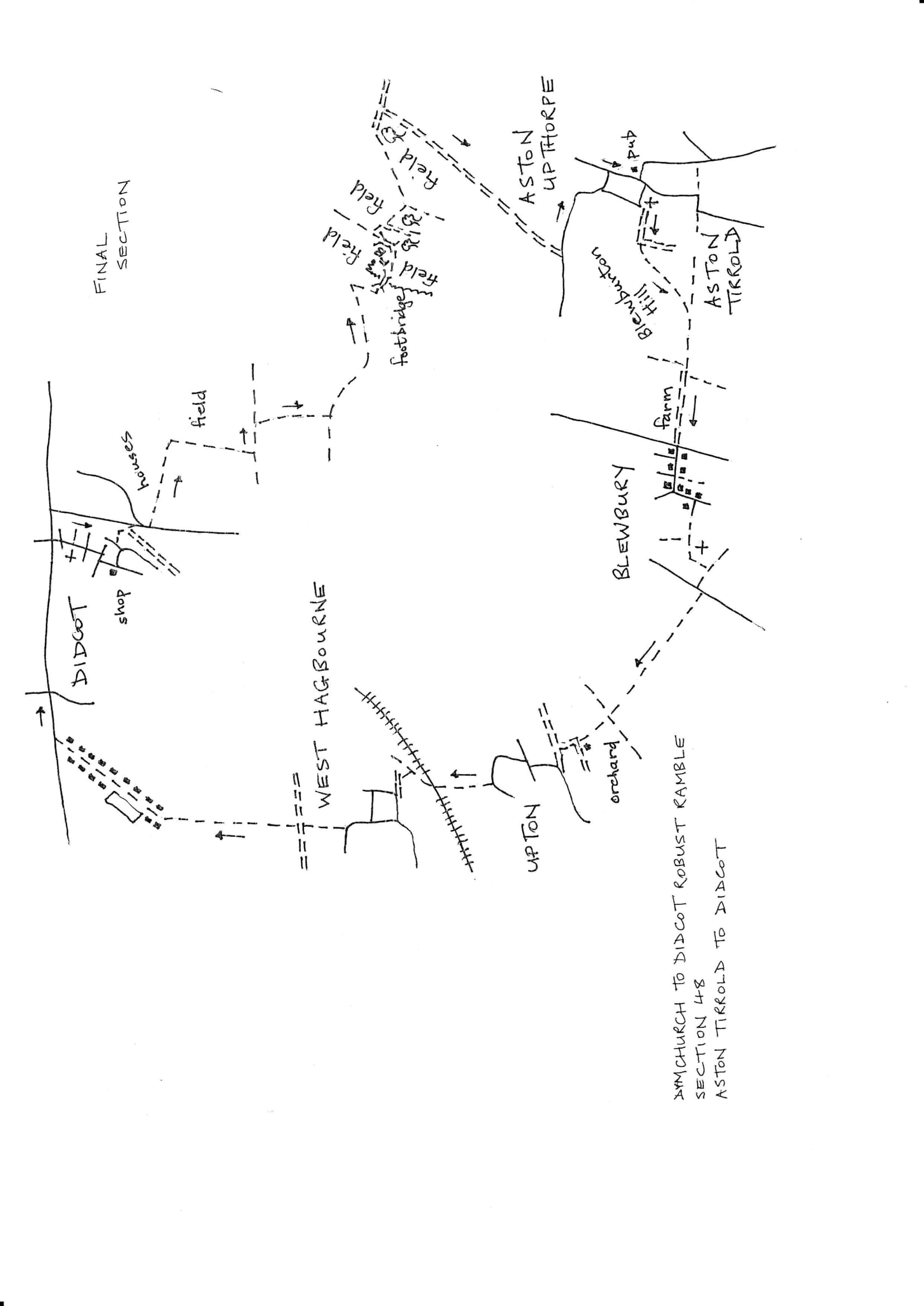
Section 48 Return
Didcot to Aston Tirrold
Walk Details
| Map | OS Explorer 170 Abingdon & Wantage |
|---|---|
| Distance/Time | 4 miles/2 hours |
| Start | Broadway pub at the lower end of Didcot main shopping street. |
| Comment | This is an easy return, mostly on bridleways which can be muddy. |
Walk Instructions
With the Broadway pub behind, turn left down the main road, past the Post Sorting Office to reach a light controlled pedestrian crossing. Cross to the other side and continue down the main road.
At traffic lights, turn right along the quiet road called High Street. Pass a former church on your right and keep on across side roads to a T-junction down at the very end.
Turn right and immediately left down Ridgeway Road. Opposite some shops turn left along Sinodun Road. At a Y-fork bear left still on Sinodun Road. In a short distance turn right up an asphalt path. Bear right up to a road (ignore a cycle track on an old railway off right). Cross the road with care and turn right for 10 metres past allotments to reach a footpath. Turn left along this broad path between a fence on your left and trees on the right.
At the end the path emerges into a field. Go straight ahead, away from the houses and field edge, to the centre of the field. Follow the path as it turns sharply right and continues down the middle of the field.
At the bottom cross a ditch and turn left on a bridleway. Go along to enter the bottom edge of the next field with a ditch on your right. Soon reach a junction of ways with power lines ahead. Here turn sharp right to follow the ditch down to a path enclosed between bushes.
Halfway down cross an equestrian bridge and go on to come to a T-junction with another bridleway. Turn left between bushes and follow an easy track for ½ mile. Eventually swing right to reach a concrete bridge over a wide stream and cross into a field.
Ignore a path going right (not signed), and turn left along the top edge of the field. At the next corner turn left out of the field on a tractor track over a bridge with ditch below into a higher field. Turn immediately right along the bottom edge of this new field with a hedge and bushes on your right.
Where the tractor track turns sharply right into the thicket, go straight on, still along the field edge. Where the hedge stops, go forward across the open field. In midfield turn left on a wide farm track, directly towards power lines.
Pass under the power lines to soon reach a corner. Here turn right onto a wide grassy way for 20 metres. Arrive at a crossing of tracks by a large evergreen tree. Here turn right to go through a wooden kissing gate and join a broad grassy way between a hedge on your right and a ditch on your left.
Go straight down here for nearly a mile; join an asphalt drive halfway and continue on down, to eventually emerge onto a road. Turn left along the road on grassy verges for ½ miles. Wind down into the village of Aston Upthorpe.
At a beech hedge turn left on Thorpe Street (confusingly Thorpe Street also goes straight on) to reach a T-junction.
Turn right and walk down past a garage to find The Chequers inn and the start of the section.