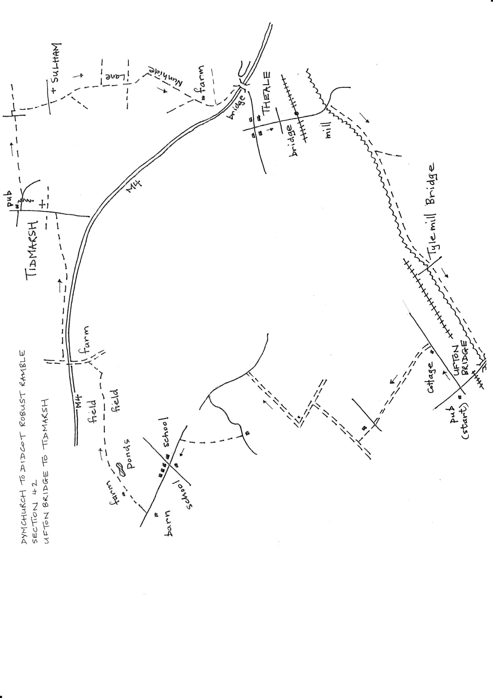
Section 42 Out
Ufton to Tidmarsh
Walk Details
| Map | OS Explorer 159 Reading |
|---|---|
| Distance/Time | 7 miles/ 4 hours |
| Start | The start is from the site of the former Winning Hand pub, now closed, near Ufton Lock on the A4. A little further north up the main road is The Spring Inn. Allow plenty of time to find parking. It's particularly difficult here now that the pub has closed. |
| Comment | This is a difficult area for walking with rivers, a canal, railway lines, major roads, a motorway and the effects of past and continuing mineral extraction. This walk has some pleasant walking in secluded countryside balanced by bridleways with tarmac or gravel surfaces. At least it's difficult to get lost. There is a short section of road walking which needs great care; a hi-viz waistcoat improves the reaction of drivers. |
Walk Instructions
Face north up the main road. The side road coming up from Ufton Lock will be across on your right and just past the building that was the old Winning Hand pub is a side road going off left to Southend. Walk up the main road and cross this side road. Continue up the pavement alongside the busy A4 main road. In 100 metres reach and pass the isolated Victoria Lodge on your left. (to reach the Spring Inn stay on the main road for ¼ mile , returning here afterwards). At Victoria Lodge, immediately turn left, off the main road, down a long straight private road for ¾ mile.
At the end reach a T-junction with a concrete drive. Cross to a fieldgate. There is no stile so climb over and go up the field edge with a hedge on your right (ignore a gate on the right into a garden). In the top corner go through a gate and continue uphill to a junction at the top with a gravel bridleway.
Turn right on this for ½ mile. Near the end pass a lake on your left. The bridleway then bears left and merges into a tarmac drive. Continue up this to an isolated house on your right. Immediately past this turn right, still on the drive.
Past the house the drive becomes a broad unmade track and continues for a good distance to eventually emerge onto a road. This road is a fast and busy two-way highway so great care is needed as there are no walkable verges.
Turn left on the road, first uphill then mostly downhill for ¼ mile. At the bottom of the hill cross a bridge then turn left down a side road called Union Road for 200 metres. This road too has significant traffic. After some way negotiate an S-bend, making sure you cross to the best side for maximum visibility.
Soon reach Bournefield Farm on your left. Here turn right off the road through a squeeze stile by a wooden fieldgate. Keep on up the farm track beyond for some way. The surface changes but the track is easy to follow. It eventually emerges onto a road by an entrance to Bradfield College. Turn left down the road and in 150 metres reach a crossroads among college buildings.
Cross straight over and continue forward away from the village centre. Keep on for some way, passing the road to the church on your left. Eventually, where the road begins to rise, by an old wooden barn on your left, turn right off the road on a tarmac drive. Walk directly away from the road, ignoring a footpath off left, and soon reach a stile by a metal fieldgate.
Over this continue along the top edge of a field to a stile at the far side. Continue through trees then on between hedges. On approaching a farm there is a choice of paths. The easiest is to continue in a straight line. Cross a stile and go forward on a farm road between buildings. At the far side go through a gateway and pass a lake down on your right.
Stay on the driveway. At a Y-fork go straight on. Immediately past a lake on your right, bear right down across grass to a gap between trees. This leads to a broken stile. Cross onto a grassy area and go straight across to a stile in the hedge at the far side.
Climb a bank to reach a waste disposal area. Bear diagonally right on a tractor track across the space to a field. Stay on the track as it heads along the top of the field towards a distant pylon. The track becomes less distinct but keep keep going to the far end of the field. Here turn left on an enclosed path with a wooden fence and conifer hedge on your right. Soon emerge onto a concrete drive by former farm buildings.
Turn left up the drive quite steeply uphill and eventually cross a bridge over the M4. At the far side turn immediately right over a stile by a metal fieldgate. Follow a broad grassy way for over ½ mile with the motorway on your right. The walking is pleasant but the motorway noise is intrusive.
Eventually the path veers away from the motorway and reaches a stile. Cross this and continue on a slightly narrower grassy track (ignore a path off right). Reach buildings and keep forward, now on a drive, to emerge onto a main road at Tidmarsh Grange. Turn left (there is a narrow pavement) and walk up through the village. Pass the parish church on your right which is well worth a visit.
Eventually reach The Greyhound pub in Tidmarsh and the end of the section.