Section 2 Return
Ruckinge to Newchurch
Walk Details
| Map | OS Explorer 125 Romney Marsh |
|---|---|
| Distance/Time | 4 miles/ 2 hours |
| Start | The Blue Anchor pub in Ruckinge village centre |
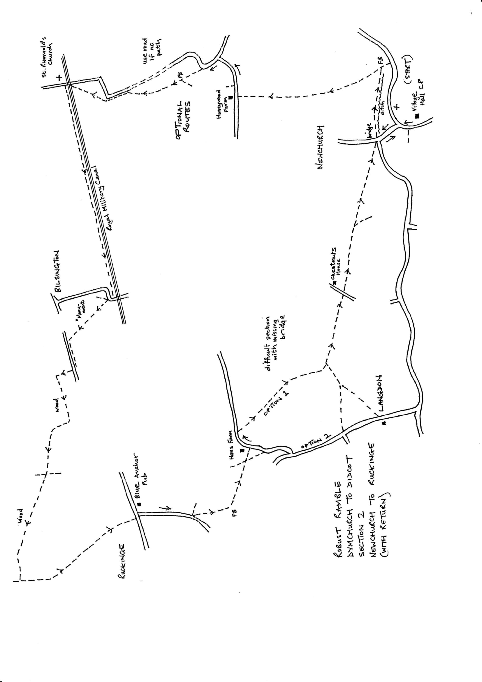
| Comment | A walk of contrasts from marshland to hilly woodland.There are demanding moments with poor stiles and paths not reinstated through growing crops. There were serious problems in this area with no evidence of some paths at all. Check the route on the map and allow plenty of time and daylight. It is always wise to carry a compass. |
Walk Instructions
Leaving the Blue Anchor turn left downhill a short way to reach a side turning signposted ‘Newchurch’. Turn down this road. Soon cross the bridge over the Royal Military Canal and go on a short distance. Where the road bends right enter a field on the left.
Two paths start from here. Take the one on the right which goes off close to the road. Follow power lines and wooden posts across the field to a footbridge. Go forward again under the wires towards gardens but just before the next wooden pole bear left towards another, currently leaning, pole in the distance (from here the path has been reinstated through the crops but it reaches the road at the wrong place).
Just past the leaning pole reach and cross another footbridge. Now bear left aiming just right of the buildings of Hans Farm. Reach and cross a footbridge out to a road.
Check the sketch map and OS map to see the routes of the options below
OPTION 1 (preferred route; if this proves impossible return to the road at Hans Farm) Turn left on the road. Having passed the farm buildings, a footpath should soon go off across the second field on your right. Follow it, diagonally left, to the far opposite corner(aiming for a distant house with pylon behind) where there is an old railway sleeper fence post. The path would bear left to aim now towards the tower of Newchurch church. There is no waymark and no sign of the path and a footbridge is missing just past the railway sleeper fence post. If the path and bridge has been reinstated, go on, heading towards Newchurch church tower. The path goes along a field edge, then across, to emerge onto a road with the house called Chestnuts just over on your left.
OPTION 2 Having emerged onto the road by Hans Farm turn right along the road to a T-junction. Turn left to continue down the road to a further junction. Here there should be a footpath off left (if this is not evident go on down the road for another 200 metres to Langdon and turn left on a further footpath across fields to the same junction mentioned below). Follow it across two large fields to a T-junction of paths at the far side. Turn right to eventually emerge onto a road just right of a house called Chestnuts.
Cross the road to a footpath opposite. Aim to the left of a pylon with Newchurch church tower ahead. Pass the pylon and continue to the end of the field. Cross a wide farm bridge into the field ahead.
Two paths diverge here. Take the lefthand one bearing diagonally left across the field directly towards the church. At the far side of the field go through a new picnic site with young trees to reach a metal footbridge. Exit onto a road junction. Go ahead down the road back to Newchurch Village Hall car park and the start of the section.